Utah Pronghorn Units South Slope, Vernal
70.6%
Public Land
801,589
acres
12,240 / 4,635ft
Min/Max Elevation
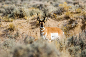
Utah South Slope, Vernal - Unit Overview
Unit South Slope, Vernal for Pronghorn covers approximately 801,589 acres, and most of this unit is comprised of public land. The dominant land cover for Unit South Slope, Vernal is shrub/scrub. From September through December, this unit receives an average of 1.01 inches of precipitation a month and the heaviest rainfall is in October. Temperatures during hunting seasons typically range from 20°F to 55°F.
Species
Pronghorn
Average Temperature
Average Precipitation
Utah Hunting Maps App
Download today, and you can record, track, and navigate for free.
